Date: 9 Sep 2026 (Europe/London) · n barrows: 129
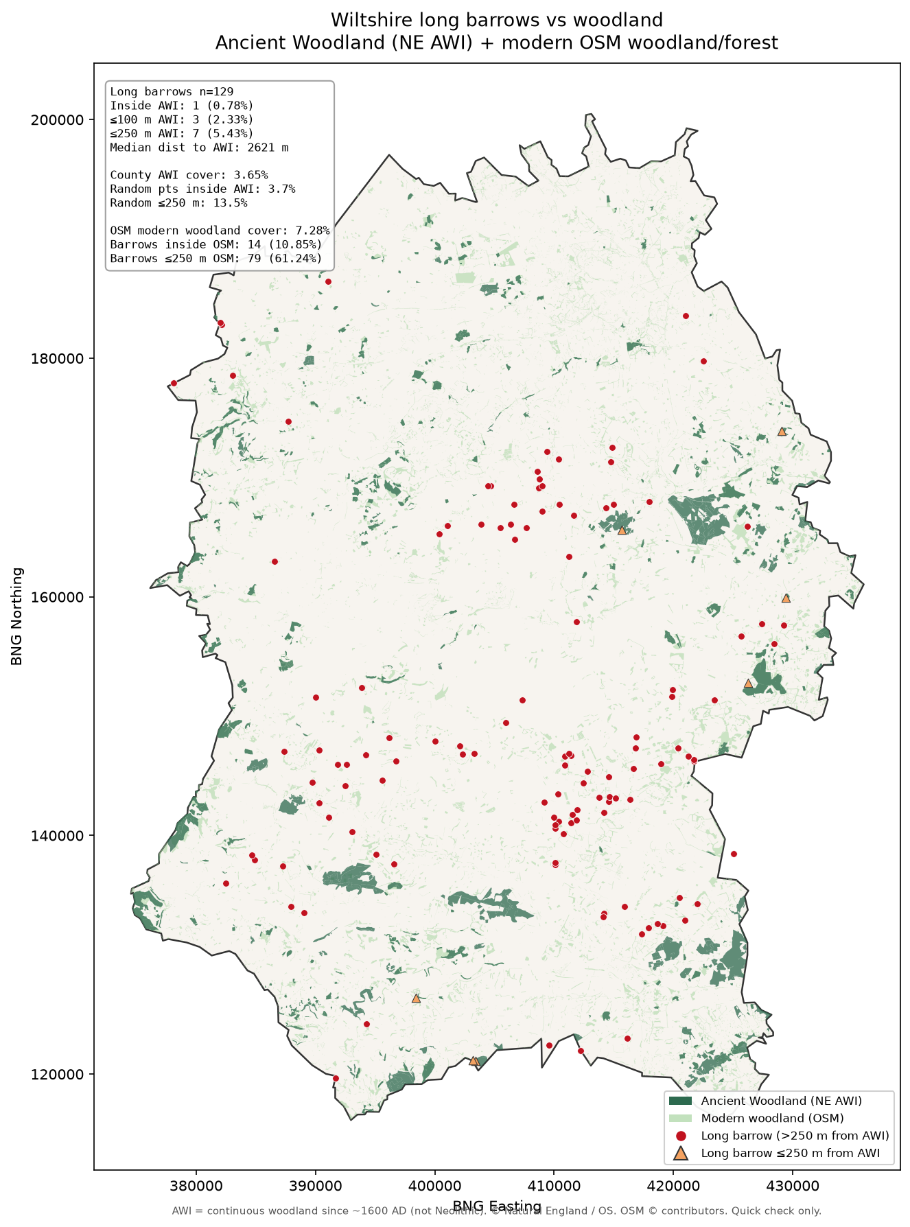
AWI = woodland continuously present since ~1600 AD. County cover ≈ 3.65% (127.24 km² of 3484.78 km²).
| Metric | Long barrows | County random (n=2000) | County area fraction |
|---|---|---|---|
| Inside AWI | 1 (0.78%) | 3.7% | 3.65% |
| ≤100 m of AWI | 3 (2.33%) | 7.4% | — |
| ≤250 m of AWI | 7 (5.43%) | 13.5% | — |
| ≤500 m of AWI | 10 (7.75%) | 22.1% | — |
| Median distance | 2621 m | 1261 m | — |
Only 1 / 129 barrow is inside AWI: West Woods (SU 15683 65628). Barrows are ~3–4× less often in/near AWI than random county points; median distance to AWI is about double the random baseline.
natural=wood + landuse=forest)Crowd-sourced; incomplete; includes plantations & small copses. County cover ≈ 7.28%.
| Metric | Long barrows | County random | County area |
|---|---|---|---|
| Inside OSM woodland | 14 (10.85%) | 7.1% | 7.28% |
| ≤100 m | 37 (28.68%) | 32.95% | — |
| ≤250 m | 79 (61.24%) | 63.3% | — |
| Median distance | 195 m | 176 m | — |
No avoidance of modern OSM woodland — rates are similar to (or slightly above) the random baseline. Small copses/plantations sit near many chalk monuments.
Partial map pattern, weak Neolithic claim.
Go / no-go: NO-GO on “long barrows avoid woodland” as a Neolithic behavioural hypothesis from this quick check. GO only as a descriptive modern/early-modern pattern: “scheduled long barrows sit away from surviving AWI patches because they sit on open chalk.”
Absolute paths: /workspace/map-overlays/woodland-check/
wiltshire_long_barrows_woodland.pngsummary.htmlstats_summary.jsonbarrows_woodland_distances.geojsonancient_woodland_wiltshire_clipped.geojson