About this map
Interactive gazetteer of Wiltshire Neolithic long barrows from open HER extracts and Historic England scheduling polygons, plus Tim Daw’s modern All Cannings long barrow. Terrain is a county-wide EA Composite DTM hillshade at ~20 m; desktop zoom shows 1 m chips.
Gold = HER certain · grey = possible.
Circle markers: gold = HER certain, grey = possible, teal = modern.
Rim arrows mark undirected long-axis bearings from north (0–180°), human-checked where shown.
Gold outline = ceremonial Wiltshire (UA + Swindon).
LiDAR: County backdrop: EA Composite DTM ~20 m (all devices). Per-barrow 1 m chips: desktop map zoom ≳14, and in the detail strip when a barrow is selected.
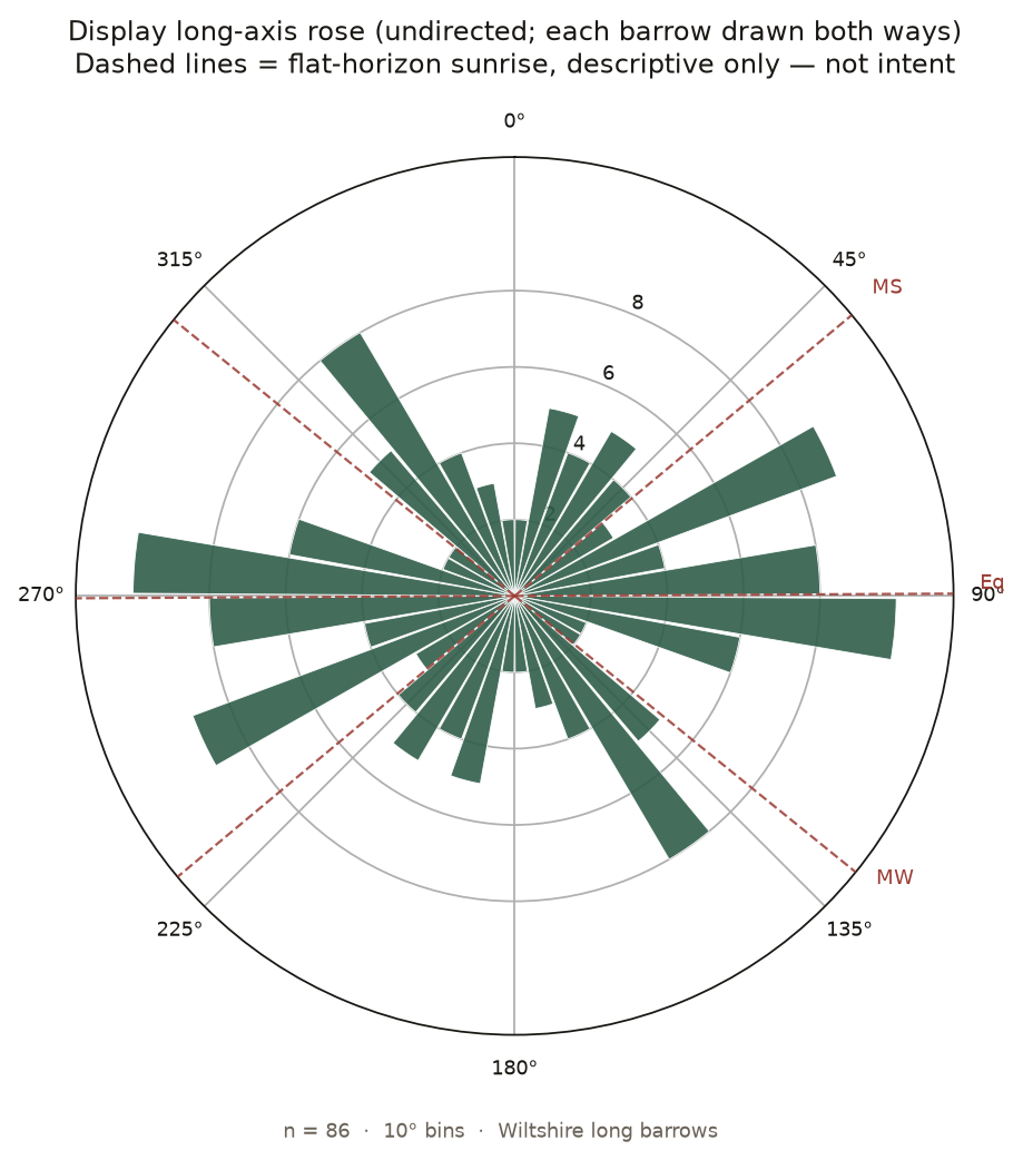
Do they face the sun?
No — not as a shared design, and not as folklore likes. They do not all run along the ridges either. The eighty-six axes we could trust mostly spread, with only a gentle east–west smear and no spike at midsummer or midwinter.
Short note on the bearings · dashed lines on the rose are sunrise on a flat horizon (drawn for scale, not a finding)
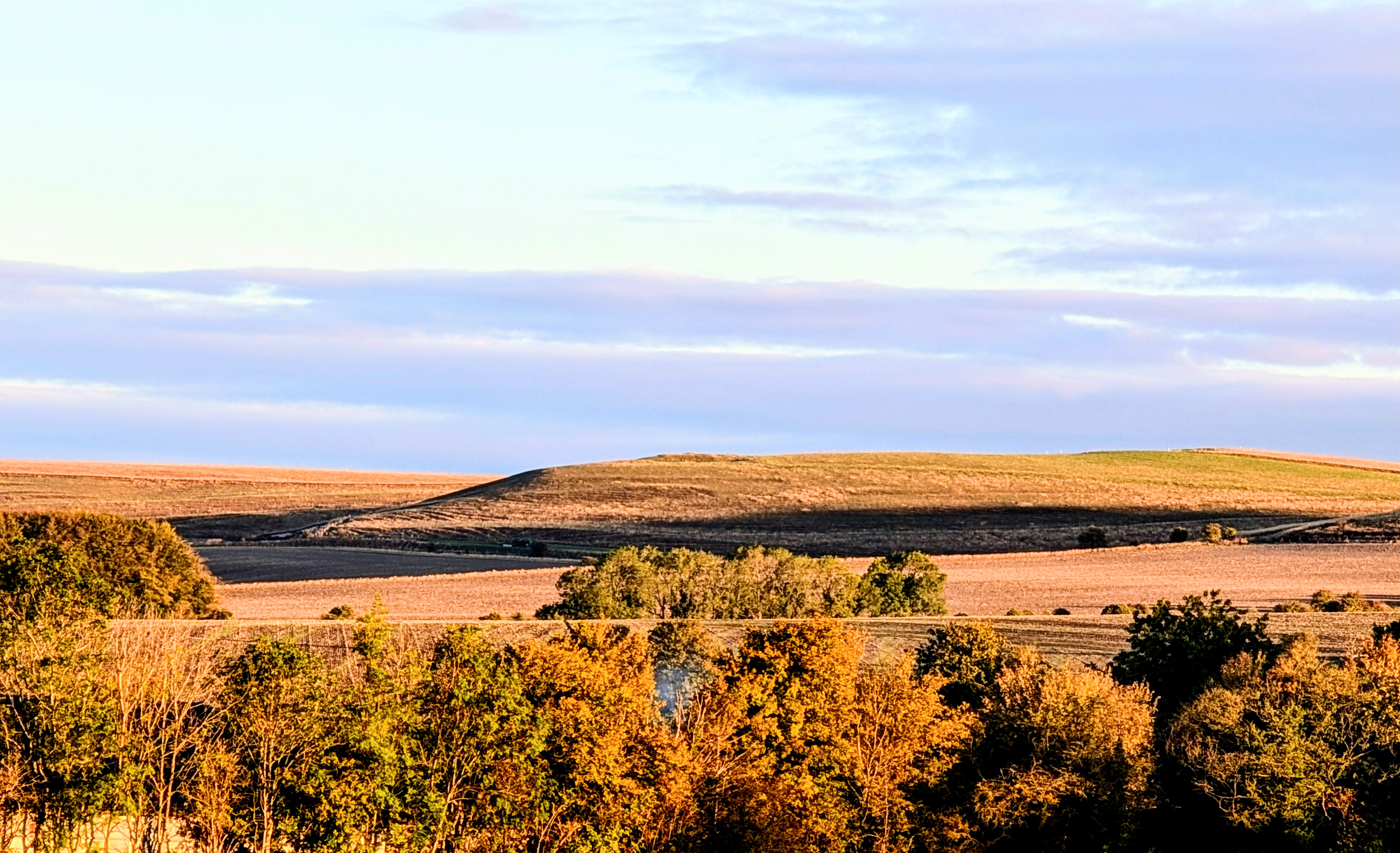
Do they stand on the skyline?
No — not as a shared design. Some do (Adam’s Grave class). Many famous ones do not. Being visible on a ridge is not the rule; length-shows approaches and a proper skyline test matter more than a pretty photograph alone.
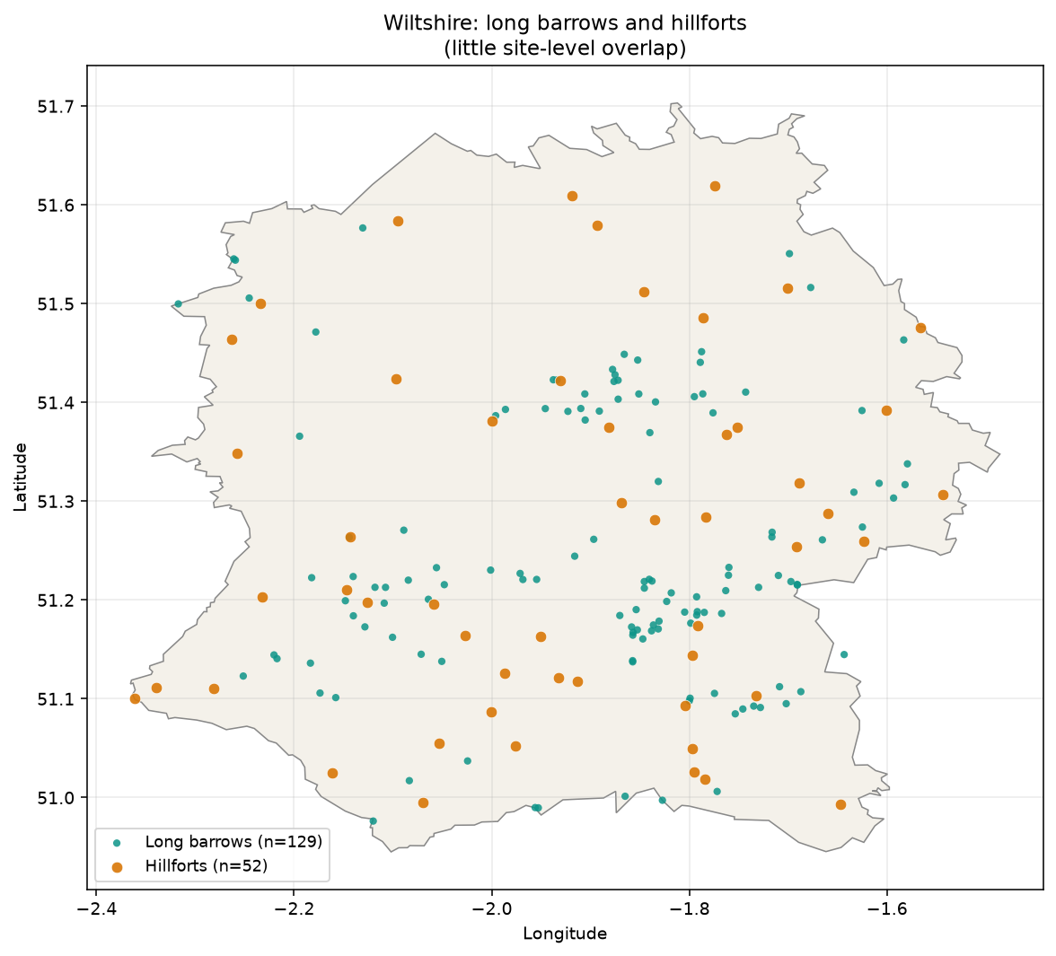
Same chalk, different seats?
Hillforts hug the scarps; long barrows sit back on the plateaux and gentle rises. The empty space between the pins is geography more than avoidance.
Long axis
Map arrows are undirected long-axis bearings from north (0–180°), human-checked where shown. They are not solar alignments or façade directions.
Typology
Chambered, earthen, and hybrid traits form a spectrum — this map does not force a binary Cotswold–Severn vs earthen class on markers or filters. See each site’s Notes for plain-language typology. All Cannings is a modern (2014–) long barrow, not a Neolithic HER site.
Sources (v1 seed)
- Wiltshire HER certain/possible points — Zenodo 10.5281/zenodo.11005373 (Wheatley recreation; underlying Wiltshire HER).
- Named Avebury / Stonehenge HER list — Kutty 2024 Zenodo 10.5281/zenodo.10989406 (compiled from HER via Heritage Gateway).
- Historic England NHLE Scheduled Monuments (OGL) — footprint + List Entry via ArcGIS FeatureServer.
- Cotswold–Severn typology: Corcoran 1969; Darvill 2004 Long Barrows of the Cotswolds; Crawford 1925; site reports (Piggott & Atkinson; Whittle; Thurnam).
- Catalogue literature: Ashbee; Field 2006; Kinnes 1992; Roberts et al. IA 47; McOmish et al. 2002 (SPTA).
- EA LiDAR Composite DTM — OGL; county backdrop ~20 m (all devices); per-barrow 1 m hillshade chips (~380 m) on desktop zoom ≥14 and in the detail strip.
Known limits
- Many HER rows lack published names; display falls back to HER / parish number.
- Long-axis bearings are human-checked where shown; sites without a clear axis appear as plain circles.
- Length/width from scheduling polygons are approximate (often oversize vs mound).
- Not a complete county inventory of every ploughed / cropmark candidate.
Licence / sources
Compilation © Tim Daw / sarsen.org · CC BY-SA 4.0. NHLE © Historic England / OGL. EA LiDAR © Environment Agency / OGL. Ceremonial county boundary © Office for National Statistics / OGL. Zenodo Wheatley recreation 10.5281/zenodo.11005373 CC BY 4.0 (underlying Wiltshire HER). Zenodo Kutty 2024 10.5281/zenodo.10989406 CC BY 4.0 (compiled from HER via Heritage Gateway). Research gazetteer; not official HER; no land access implied.