Tim Daw · September 2026
Local working note (not published)
A quick look at how the Wiltshire long-barrow gazetteer sits against the 52 Hillforts of Wiltshire. Three checks: overlay, woodland, then geology and geography.
Interactive overlay (local): ../wiltshire-hillforts-long-barrows.html
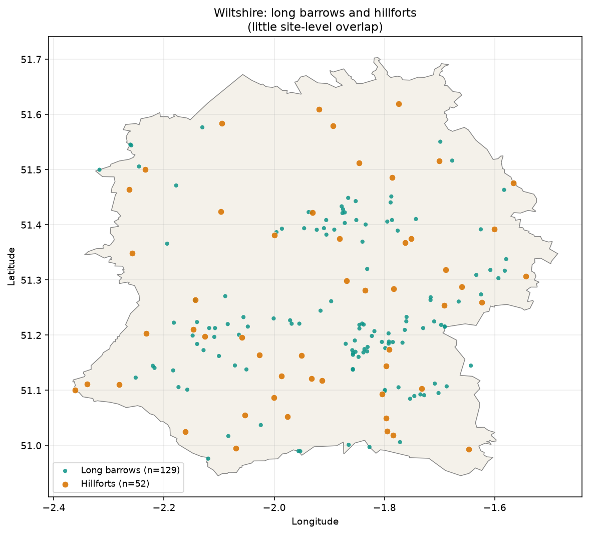
Put the two pin sets on one map and the empty space between them is the first thing you see. They share the county. They barely share sites.
Figure 1. Long barrows (n = 129) and the 52 hillforts. Little site-level overlap.
They are thousands of years apart. That alone is not a design rule — Neolithic barrows and Iron Age forts were not choosing past each other in one planning meeting. The interesting question is whether they still occupy the *same kind of ground*, and if not, what actually splits them.
One guess was that long barrows avoid woodland. Against Natural England’s Ancient Woodland Inventory they do sit away from surviving AWI: only one barrow falls inside a polygon (West Woods), and barrows are several times less often in or near AWI than random points in the county. Median distance to AWI is roughly double the random baseline.
Against modern OSM woodland there is no avoidance.
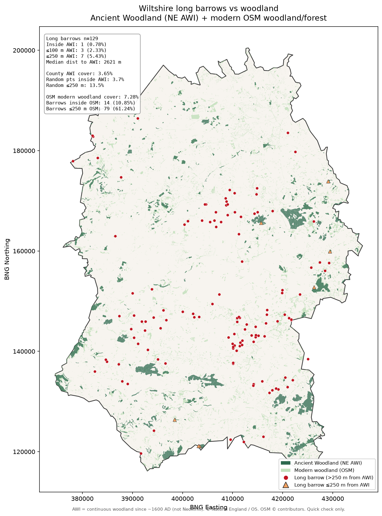
Figure 2. Barrows against ancient woodland (and modern woodland context in the analysis pack).
That pattern is mostly chalk downs versus clay-vale woodland, plus find and survival bias. AWI records woodland since about 1600 AD. It is not Neolithic cover. So woodland was the wrong first question: both monument classes already prefer chalk, and woodland mostly does not.
Using BGS DigMapGB-625 bedrock (regional scale):
| Set | On chalk | Off chalk |
|---|---|---|
| Long barrows (129) | **93%** (120) | 7% (9) — mostly Great Oolite |
| Hillforts (52) | **71%** (37) | **29%** (15) — Corallian, Great Oolite, Gault/Greensand, Lambeth/Thames |
Both prefer chalk. Hillforts keep a larger non-chalk minority (north-west and scarp country). Shared chalk explains why they live in the same *landscape*. It does not explain why the pins barely touch.
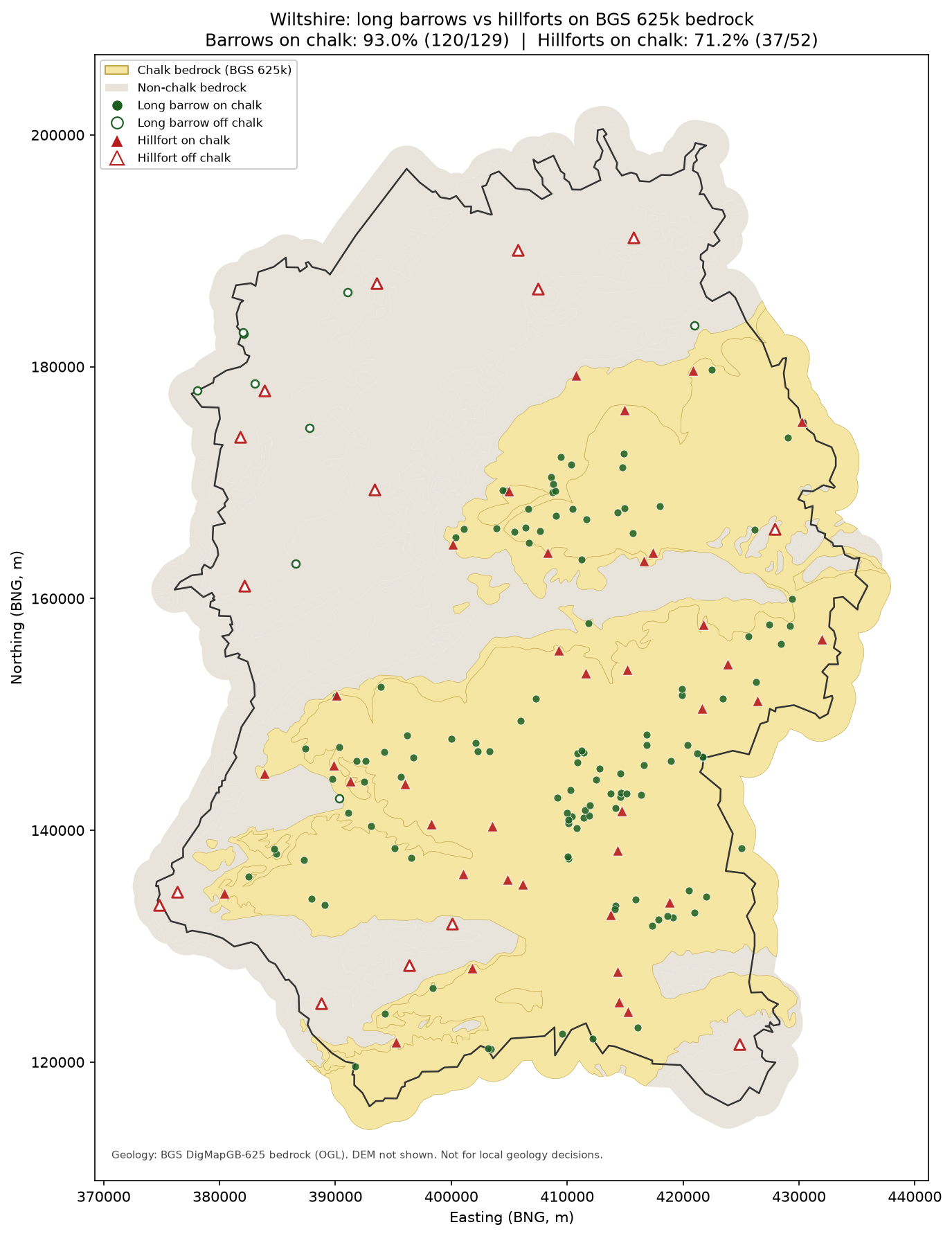
Figure 3. Barrows and hillforts on chalk (pale) versus other bedrock.
Coarse DEM (Terrarium ~30–40 m) and simple neighbourhood metrics:
| Metric | Barrows | Hillforts |
|---|---|---|
| Elevation (median) | ~147 m | ~177 m |
| Local prominence vs ~1.5 km mean | ~**+7 m** | ~**+41 m** |
| Distance to chalk–non-chalk edge | ~4.6 km | ~3.1 km |
| Nearest neighbour within class | ~1.2 km | ~4.2 km |
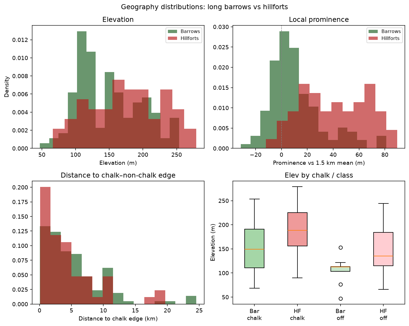
Figure 4. Distributions: elevation, local prominence, distance to chalk edge.
Hillforts sit higher, and much more locally proud — scarp and spur seats. Long barrows sit back on chalk plateaux and fringes, in tighter clusters. Only about a quarter of barrows lie within 2 km of a hillfort.
Analysis packs (stats, GeoJSON, scripts):
Compilation · Tim Daw · working note · September 2026